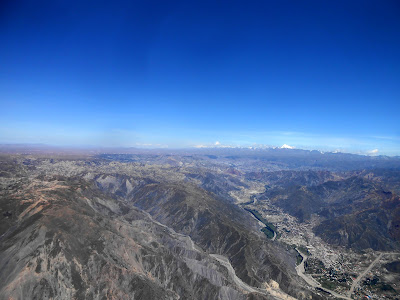
Waw, La Paz quite a shock after all this time in the middle of nowhere. A massive city made of red bricks located at an altitude of 3600m just under the altiplano. The agglomeration is literally like a massive octopus that would spread his tentacles in all the nearby valleys. The setting is really impressive as it is possible to see the huge snow capped mountains of the cordillera real from many spots in the city.
 |
| View of La Paz from El Alto |
Straight away I had quite a nice feel with the city. Yes it is true, it is a bit cahotic, can be quite dangerous, but I liked the dynamism, the colors in the market and the overall atmosphere. Sometimes it is hard to know why you like a city, but I was definitely feeling good there.
We visited the city for a few days as the paragliding guys of Andes Extremo were busy with other stuff. A good opportunity to get re-acclimated to altitude climbing the steep streets.
The entire city is like a massive market. There is a street for everything you are looking for. The electronic neighbourhood, the fruit neighbourhood, the stolen stuff, the spices, the clothes.... Really fun to go shopping in La Paz, but it takes a bout a day wandering in the maze before you find everything you are looking for.
After a few days, the day of flying arrived. We met up with the Alem brothers from Andes Extremo and got out of the city to the flying spot of Yanari.
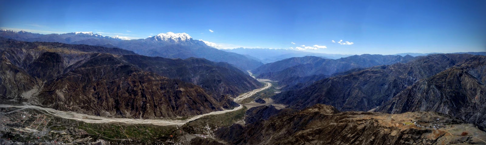
The spot is amazing, located right in front of the massive Illimani (highest peak of the cordillera Real with 6438m). We got really lucky with the weather as the whole cordillera was cloud free.
 |
| View from the take off |
 |
| Yes it's a good spot! |
The day was pretty stable. A few pilots went straight down, but we managed to find a good thermal and climbed out. The views of the altiplano were stunnning. Geo got blocked by an inversion layer at 4250m. I managed to go through it and got to the altitude of 4880m.
 |
| The altiplano with La Paz in the distance |
 |
| More Altiplano with the Huyana Potosi in the distance |
The usual cross country route is towards La Paz, but this doesn't give much space to do a long cross country. On this day I got the chance to get nearly zero wind, so I decided to go towards the south to see what it would give.
 |
| The view on the other side |
I crossed a few little valleys a managed to make my way to a big ridge right in front of the Illimani. I was really tempted to carry on towards the south, but it would have made the rescue complicated. So I made a turn point a the end of the ridge and started to come back, thinking I could maybe fly all the way back to La Paz, which would have been a great cross country flight.
 |
| The ridge with the turn point antenna |
 |
| Selfiellimani |
On the way back the conditions were really turbulent and this time I really struggled to pass through the inversion layer, but finally got it.
 |
| The way back |
Then I commited an error passing under it another time, not being patient enough (need to learn to take my time more!!!), so I landed in the valley, just short of 2 kilometers to the official landing site. A great flight any way.
THE TRACK
This has been the only flight in La Paz, but a memorable one. Thanks to the Andes Extremo team for taking us there.
We got back to La Paz to enjoy a massive fruit sald in the market (1 pound for a mountain of fruit and ice cream!)
Bonus Pics:


Aucun commentaire:
Enregistrer un commentaire