Next stop was the Quilotoa loop, a serie of pretty remote Andean villages located at about 3 hours south west of Quito.
On the way there we passed near the Cotopaxi still erupting. There were hashes everywhere, the country side was grey. An old lady sitting next to me in the bus told me that the people were very concerned (which is understandable when you have a massive volcano ready to explode on your door step) and that the hashes were already creating issues with agriculture and cattle.
 |
| Passing through the ashes |
After the city of Latacunga (situated in the main north-south Ecuadorian valley) we started to climb into the Andes. It was surprisingly green and the terrain was mainly rolling hills. A paradise for paragliding if the wind was a little bit weaker.
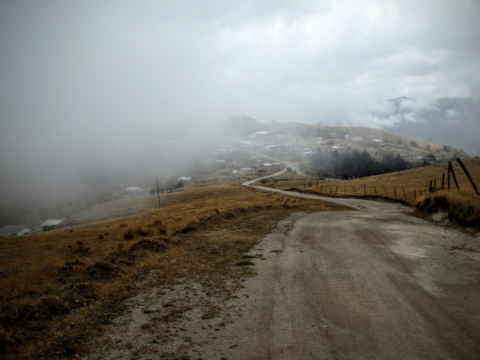
After a few hours on the bus, the winding roads changed from tarmac to dirt and the landscape became more dramatic with a massive canyon on the side of the road. We finally arrived in the little village of Chugchilán just in time to play a game of volley ball (national sport as it appears) with the locals.
 |
| Volley ball pitch |
 |
| View from the village |
The next day we set off for a very pleasant hike that took us through a few others high altitude villages. It was crazy once again to witness people living (so differently from us) there on the steep slopes or on the cold plateau making a living from agriculture and farming. Here there is no intensive agriculture, everyone has his little bit of land and cultivates it with its own hands.
 |
| On the way up |
 |
| On the ridge getting to the villages |
 |
| Bean field |
 |
| Vote 18! |
The next day we decided to finish the so called Quilotoa loop going hiking from Chugchilán to Quilotoa. We left our big bags with a car and started the nice 10km hike with 1000m+ of ascent that took us all the way to the famous Quilotoa lake. An impressive volcanic crater filled with water.
 |
| The extreme hikers |
 |
| Crater conquered |
 |
| The famous Quilotoa lake |
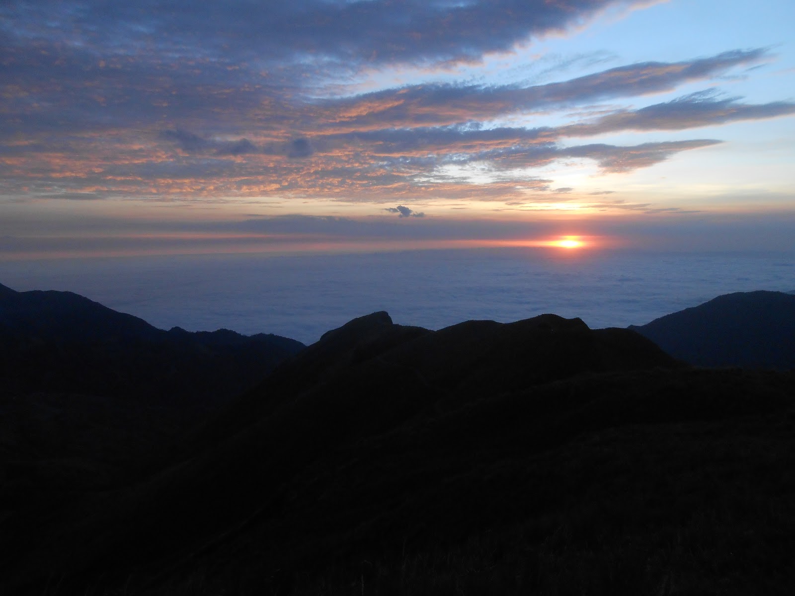
Ariving in Quilotoa, Geo and I didn't quite had enough and it was a bit too cold to stay in the rooms. So we took our gliders and went for a wander around to see if we could find a possible take off site. The wind was still too strong, but climbing up above the village offered us another perspective. A sea of cloud on the westerly side of the cordillera. It was absolutely magical! It was even possible to see the gigantic snow capped volcanoes (Chimborazo, Cotopaxi and others) on the horizon on the eastern side. We stayed there till sunset feeling like we were on an island floating above the clouds.
On thing is certain, this place has an amazing potential for paragliding and would be worth exploring in another season with less wind. If you head up to Ecuador with a glider around November I would recommend to give it a try. Apparently it is even possible to do flights from the cordillera all the way to the valley at sea level. That would make for a nice 3000m top to bottom.


Hi Dear,
RépondreSupprimerI Like Your Blog Very Much. I see Daily Your Blog, is A Very Useful For me.
You can also Find Mindo cloud forest tour Book your trip online for Mindo cloud forest day tour. We provide a full explanation of the history & process of the finest world quality of cacao that is produced in Ecuador.
Visit Now:- https://www.ecuatouring.com/trip/mindo-cloud-forest-tour/